Connecting Bronx Waterfront Communities: A New Harlem River Greenway
By Emily Kennedy, AICP, Transportation Planner

Overview map of the greenway corridor
Communities in the Bronx have been historically disconnected from the Harlem River waterfront by geographic and infrastructure barriers. While Manhattan residents have access to the Hudson River Greenway, the industrial waterfront on the Bronx side has rail lines, waste treatments centers, and distribution depots. Bronx communities have long voiced the desire for a continuous greenway and improved connectivity to upland neighborhoods.
Sam Schwartz has been supporting New York City’s Department of Transportation (NYCDOT), working with community and city partners, in developing a greenway along the Harlem River in the Bronx. When complete, the greenway will consist of a continuous 7-mile, shared-use path connecting Van Cortlandt Park with Randall’s Island.
Various plans have tried to identify ways to better connect the Bronx with its forgotten waterfront. The idea of creating a greenway along the Harlem River has been proposed since the 1990s. While the idea of a greenway connecting parks and historic landmarks and providing waterfront access to Bronx residents is not new, this plan is different in that it proposes a path for implementation.

Highways block access between neighborhoods and the Harlem River
Greenways, in New York City, are defined as continuous, multi-use pathways for non-motorized transportation and recreation along natural and man-made linear spaces, such as rail and highway rights-of-way, river corridors, waterfront spaces, parklands and, where necessary, city streets. In August 2022, New York City was awarded a $7.25M federal RAISE grant to expand the citywide greenway network. As part of this groundbreaking effort, the city identified several “Early Action” corridors across the five boroughs. While the Harlem River Greenway is not part of the RAISE grant, but is city-funded, this project will inform the next greenway project along another diverse waterfront in Queens, among the others that are part of the expansion.
The goals of this project include improving access and safety, addressing environmental justice and health, as well as improving equity by delivering critical public space to a community too often left behind. The vision of this plan is to improve waterfront access by creating connections to open space that are otherwise inaccessible, enhancing inland bike routes, and improving connectivity to commercial and residential areas.

Industrial uses along the Harlem River
This area of the Bronx is particularly challenged by steep topography, the rail lines and highways that segment the borough, and private industrial lots that pose challenges for accessing the waterfront. The entire site area falls within a state-designated “Environmental Justice Area.” It is particularly affected by the urban heat island effect, a phenomenon where urbanized areas experience higher temperatures due to buildings, roads, and other infrastructure that absorb and re-emit the sun’s heat more than natural landscapes. While these characteristics pose challenges to installing a greenway, they also demonstrate the pressing need for better access and more greenery.
Extensive community outreach has been essential to this planning process. Community visioning sessions were held last April to seek feedback on each segment of the greenway. Residents were asked about what amenities they would like, the current conditions of the streets in the site area, and what destinations were important to connect. Since the start of the planning process last spring, NYCDOT and members of the greenway planning team have gone on over 14 site visits, as well as attended over 20 community events to learn from residents and gather insights on connectivity and access. Currently, the planning team is involved in establishing route alternatives and plans to seek feedback from the community in the spring of 2024.
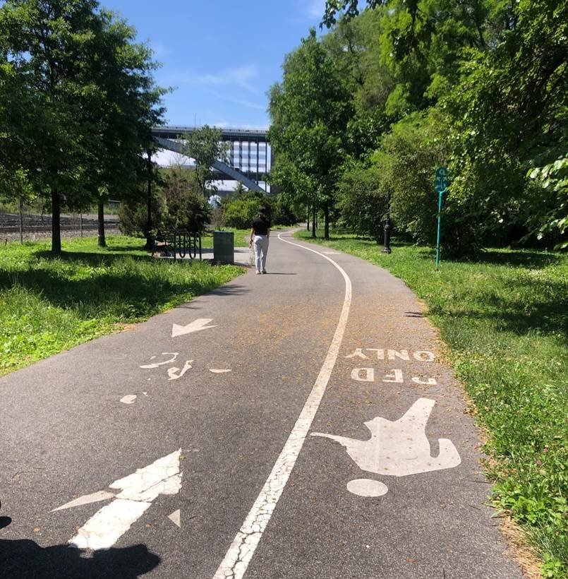
An extant multi-use path along part of the waterfront
Thanks to RAISE grant money and the mayor’s initiative, New York City’s commitment to a 40+ mile greenway expansion effort, focused on underserved, outer-borough communities, will help fill critical gaps in the city’s bike and pedestrian network. This planning process offers the opportunity to connect with residents in a collaborative, community-driven way. The new greenway will not only expand access to active transportation, but enhance cycling and pedestrian safety, support economic development, and address equity concerns by improving access to green space, reducing the impacts of heat, and better connecting Bronx waterfront communities with the rest of the city.
Images: New York City Department of Transportation